| Ⅰ | This article along with all titles and tags are the original content of AppNee. All rights reserved. To repost or reproduce, you must add an explicit footnote along with the URL to this article! |
| Ⅱ | Any manual or automated whole-website collecting/crawling behaviors are strictly prohibited. |
| Ⅲ | Any resources shared on AppNee are limited to personal study and research only, any form of commercial behaviors are strictly prohibited. Otherwise, you may receive a variety of copyright complaints and have to deal with them by yourself. |
| Ⅳ | Before using (especially downloading) any resources shared by AppNee, please first go to read our F.A.Q. page more or less. Otherwise, please bear all the consequences by yourself. |
| This work is licensed under a Creative Commons Attribution-NonCommercial-ShareAlike 4.0 International License. |
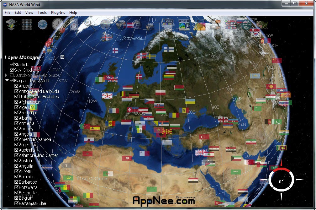
NASA World Wind popularly known as a magnifying glass of earth (it is the crystal of variety of technologies), co-produced by the NASA, similar to bird’s eye view tool of Earth Viewr 3D (discontinued), but more powerful, authoritative and completely free.
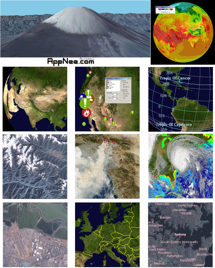
This 3D engine of NASA World Wind allows you to see any one corner on the earth from outer space. Based on online database, World Wind can reach a very high – 15 m per pixel resolution, that means we can see clearly streets.
In addition, depends on its SRTM (Shuttle Radar Topography Mission) function, you can enjoy a 3D flight trip to the earth, experience the feeling of fly over the Mount Everest. And NASA World Wind is able to simulate an animation of variety of climate changes in real time.
// Key Technologies //
- 3D engine – use the computer 3D hardware acceleration
- Blue Marble – make World Wind’s highest resolution up to every pixel represents 15 meters
- Land Sat 7 – view images data of the past time
- SRTM – display a dramatic view of the Earth at eye level
- Animated Earth
- MODIS – severe events monitoring
- GLOBE – view the global temperature change
- Country & State Borders
- Place Names – check the namegeographical names (even if it is a small village)
- Visual Tools – variety of visual guides that help the user’s experience such as latitude and longitude lines
- Landmark set – display actual 3d models of landmarks on the earth
// Official Promo Video //
// System Requirements //
- Microsoft .NET Framework 2.0 is required (on Windows 8/8.1, you should install the 3.5)
// Related Links //
- Complete Guide to World Wind Help Resources
- World Wind Online (Run World Wind from your browser with no installs)
- World Wind Keyboard shortcuts
// Download URLs //
 (v1.4.0 Final | Homepage)


| If some download link is missing, and you do need it, just please send an email (along with post link and missing link) to remind us to reupload the missing file for you. And, give us some time to respond. | |
| If there is a password for an archive, it should be "appnee.com". | |
| Most of the reserved downloads (including the 32-bit version) can be requested to reupload via email. |