| Ⅰ | This article along with all titles and tags are the original content of AppNee. All rights reserved. To repost or reproduce, you must add an explicit footnote along with the URL to this article! |
| Ⅱ | Any manual or automated whole-website collecting/crawling behaviors are strictly prohibited. |
| Ⅲ | Any resources shared on AppNee are limited to personal study and research only, any form of commercial behaviors are strictly prohibited. Otherwise, you may receive a variety of copyright complaints and have to deal with them by yourself. |
| Ⅳ | Before using (especially downloading) any resources shared by AppNee, please first go to read our F.A.Q. page more or less. Otherwise, please bear all the consequences by yourself. |
| This work is licensed under a Creative Commons Attribution-NonCommercial-ShareAlike 4.0 International License. |
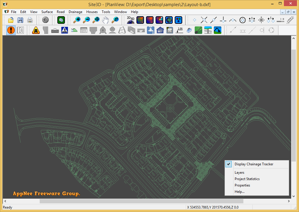
Site3D is a fully functional civil engineering 3D design software that is mainly used for road system and infrastructure engineering design. It can help architectural design engineers quickly and accurately design the entire site, including roads, intersections, sidewalks, ground interfaces, contours, volumes, houses, drainage systems, and so on.
Site3D has powerful and sophisticated functions, simple and intuitive user interface, employs interactive 3D view, is very easy to use (without any training required), and comes with good compatibility. As a professional 3D engineering design software, it starts from an engineer’s point of view, and fits the thinking work of engineers, thus doubles the work efficiency of engineers – i.e. they are able to complete delicate, complex and excellent designs in a shorter time now.
Site3D allows user to design drawings and models of construction projects in software, supports integration into BIM systems, and can be exported in the compatible IFC (Industry Foundation Classes) file format, so as to integrate with any BIM viewers. In addition, its graphics conversion function can easily and accurately transform 2D drawings into useful 3D surface models. These can be very helpful for users who need to analyze the ground and map the geographical environment.
// Key Features //
| Design features |
|
| Design roads, footpaths and cycleways |
|
| Design 3D roundabouts |
|
| Design drainage systems |
|
| Design ponds and general earthworks |
|
| Existing surface |
|
| Boreholes |
|
| Construction tools |
|
| Layers |
|
| Import / export |
|
// Official Demo Video //
// Edition Statement //
AppNee provides the Site3D multilingual portable full registered versions for Windows 32-bit & 64-bit.
// Related Links //
// Download URLs //
| Version | Download | Size |
| v2.603 |  |
12.7 MB |
(Homepage)
| If some download link is missing, and you do need it, just please send an email (along with post link and missing link) to remind us to reupload the missing file for you. And, give us some time to respond. | |
| If there is a password for an archive, it should be "appnee.com". | |
| Most of the reserved downloads (including the 32-bit version) can be requested to reupload via email. |